Bird Island, the Kingdom of Birds in Qinghai

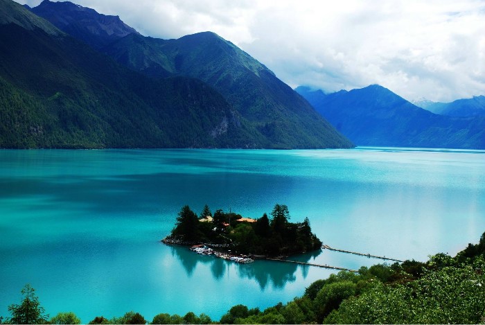
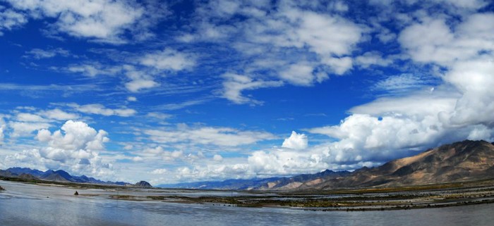
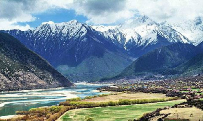
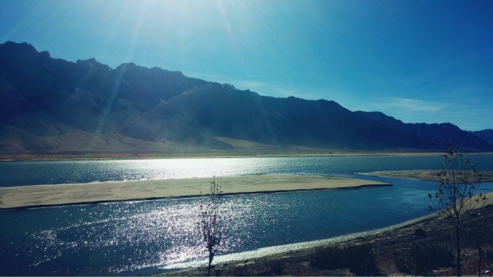
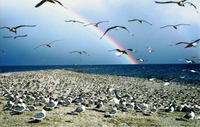
The bird island of Qinghai Lake is named after the hundreds of thousands of migratory birds inhabiting the island. It lies northwest of Qinghai Lake, one of the most beautiful lakes in China, is connected to the bank on one side whilst the others are surrounded by water.

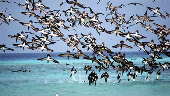
It is similar to the pet of almost all people who love nature. Maybe you are fascinated by their sweet singing in the dense forest. Or when you see birds flying freely in the sky, a feeling of worship will fill your heart? So what do you feel when you see groups of wild birds flying on the wide lake? Here, on the bird island, which is famous for bird kingdom and heaven, you can enjoy the wonderful world yourself.

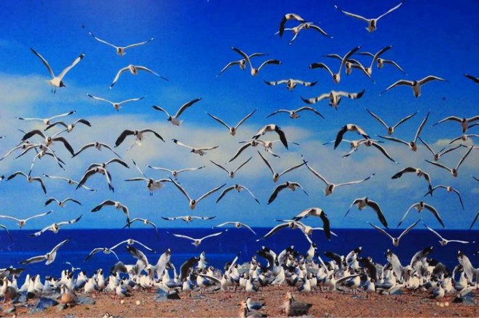
Bird island includes two islands, one is haixipi in the East, the other is haixishan in the west, which is four times smaller than the former Island, but it is the place where most birds gather in the lake. When spring and summer come, many birds come here from distant mountains and deserts to breed. In the most noisy April and may, the number of them can reach 10000, 80% to 90% of which stop in Haixi mountain to lay eggs. The eggs of Haixi mountain are all over the island, also known as “egg island”.

Why does the island attract so many birds? Because of its flat landform, mild climate, close to the water surface, it can produce rich floating grass and fish. The environment here is also very quiet. It is a natural space for birds to breed and inhabit.

Bird island has charming natural scenery and many beautiful wild birds. It is the only place for many tourists to travel in Qinghai. It has been listed as a National Nature Reserve, which mainly protects birds and provides a great place for tourists to visit.

Yangling Mausoleum of Han Dynasty, the First Underground Museum in China

The Yangling Mausoleum of the Han Dynasty, in short Han Yang Ling, is located at Zhangjiawan Village, about 20 kilometers north of Xi’an City, Shaanxi Province. It is a joint tomb of Liu Qi, a notable emperor of the Western Han Dynasty, and his empress Wang. It was built in the year 153 AD and covers an area of 20 square kilometers. It is a magnificent and abundant cultural relic, comprising the emperor’s tomb, empress’ tomb, the south and north burial pits, ceremonial site, human sacrifice graveyard and criminals’ cemetery.

Neatly arranged and centered with the emperor’s tomb, Han Yang Ling Mausoleum reveals the strict hierarchical social structure. The Outside Pits Exhibition Hall was opened in 2006 and is the first underground museum in China.

Liu Qi, the fourth emperor of the Western Han Dynasty, and his father, Liu Heng, the emperor of the Han Dynasty, jointly created the first rule of the Chinese monarchy, the rule of Wenjing. In the third year of the later Yuan Dynasty (141 BC), it collapsed in Weiyang palace of Chang’an City and was buried in Yangling [5]. Yang Mausoleum was built in the fourth year of the Yuan Dynasty (153 BC), from the beginning of emperor Jingdi of Han Dynasty to the burial of the queen. The construction of Yang Mausoleum lasted for 28 years.

The archaeological research achievements of Hanyang mausoleum have attracted worldwide attention. Its drilling, excavation and research achievements have laid a solid foundation for the study of the burial and burial system of the Western Han Dynasty imperial mausoleum, provided a large number of detailed material materials for the study of the political, economic and cultural life of the Western Han society, and played a leading and reference role in the archaeological research of the Western Han tombs. The Yangling archaeological exhibition hall The opening to the outside world of “wenjingzhi” shows the whole world the grand occasion of “the rule of wenjingzhi”.

Muslim Quarter, Beiyuanmen Muslim Food Street

Located in the north of West Street in the center of the city, the district covers several blocks and is inhabited by more than 20000 Muslims. There are about ten mosques in the Muslim Street area, of which the Great Mosque in Huajue lane is the most famous and popular. The Muslim food and souvenir market is another feature of the region. Beiyuanmen Muslim market, located in the north of Gulou, is the best choice after sightseeing in the city center. It’s about 500 meters (547 yards) long from the south to the north. You can get to the street through the arch under the drum tower. The street is covered with dark stones and trees in summer; the buildings on both sides of the street follow the style of Ming Dynasty (1368-1644) and Qing Dynasty (1644-1911). Some buildings are restaurants, while others are shops. But there is one thing in common: all are Muslims.

Mutton stewed unleavened bread is a special snack in Xi’an, very delicious. Stir fried rice with pickled vegetables and chili peppers is very delicious. It’s a real pleasure for you to eat it in the hot summer. Roast beef, lamb or lamb is another snack that makes your mouth water. Roast the meat on the charcoal fire, add some seasoning to the meat, and you can eat it. The most famous snack in this street is Jiashan baozi. The main raw material of steamed bun here is beef and mutton soup.

There is also a fruit pie made of persimmons, which is considered to be a unique snack in Xi’an. These pies are made of Persimmon in Lintong District, Xi’an City, Shaanxi Province. When making pies, first remove the persimmon skin, mash it into meat filling, mix it with flour, then put osmanthus and sugar in it to make filling, and then fry it in oil. When you eat them, you will feel delicious, sweet and soft.

There are many other snacks in the street, such as bacon, casserole, noodles and so on. They are waiting for you to enjoy.

Three Gorges Dam Project, World’s Largest Hydropower Project

Being the world’s largest hydropower project, Three Gorges Dam Project has created many “Firsts” such as the most efficient dam in flood control, the most difficult construction work and the largest migration project in the world.

Three Gorges Dam is a project has been completed of great weight to China. What are the advantages of the Three Gorges Dam? So far, the project has begun to bring benefits to Chinese people in mainly five aspects: flood control, power generation, navigation, drought resisting and tourism.

Flood control is a vital Three Gorges Dam benefit. Since ancient time, Yangtze River floods have been disasters to people, especially in the section of Hubei province and Dongting Lake area. Three Gorges Dam can efficiently store the water from upper stream and reduce the flood during the flood season. Three Gorges Dam is world’s largest hydropower station with a total capacity of 22.5 million kilowatts and the annual power generation is 100 billion kilowatt hours, which greatly meets the electricity demands in middle and eastern China. Located in the middle of China, this hydropower station supplies power to the middle, eastern and southern China, that within 400 to 1,000 km economic transmission distance of the load, including the provincial regions of Henan, Hubei, Hunan, Jiangxi, Chongqing, Shanghai, Jiangsu, Zhejiang, Anhui and Guangdong.

Located in the middle reach of Yangtze River, the Three Gorges Dam raises the water level in its upper stream and greatly improve the waterway conditions from Chongqing to Yichang, totaling 660 kilometers (410 miles). In dry season, the water in its lower reaches can get ample supply to ensure regular water transport. The ships of ten thousand tons can sail directly between Chongqing and Wuhan even further and Shanghai. Besides, due to the improvement of the navigable waterways, the ship size and fleet size are accelerated standardization and become larger, and the transport costs can be expected to reduce.

West White Poplar Gully, the Natural Summer Resort

In the West White Poplar Gully, there are snow peaks, steep mountains, tall spruce and green grass. The white yurts, exquisite villas, elegant sanatoriums, hotels and snack bars, all of which add to the vitality of the deep mountain canyon. The scenery is more beautiful. A waterfall with a height of more than 40 meters and a width of about two meters is like a white practice hanging in the air. It flows down like a silver dragon flying and roars like a drum. At the falling place of the waterfall, the spray is all over the place, and the water drops are flying. It is like drizzle in the mossy rocks and dark green trees on both sides, cool and pleasant.

The word ‘Urumqi’ originally means ‘Beautiful Pastures’ in Mongolian. Fortunately in the suburb of the city of Urumqi there lies the Southern Pastures, a beautiful pasture the pastoral Kazakh inhabit and graze in summer. Covering an area of 119 square kilometers (about 45 square miles), Southern Pastures, the natural large and famous summer resort, 75 kilometers (about 46 miles) away from the city, is located in the Southern Mountain, the area at the northern foot of Karawuquntag Mountain.

It takes you about one hour by bus from Urumqi to get to West White Poplar Gully which is one of most typical sights. On the way, you can see the bright snowcapped Karawuquntag Mountain, the wandering valleys, hear the gurgle of springs, and smell the lush spruce trees. In the thicket of the lush spruce trees, let your eyes delight in the traditional villas and the scattered Kazakstan yurts as they paint the grassland.

As you stand in Southern Pastures, you can see the forest of emerald green spruce on a chain of undulating grass hills dotted with combined flocks and herds. As you immerse yourself in this beautiful site, the singing of the Kazakh may envelop you and inspire you to sing with them. You can visit one of the traditional yurts locating in the spruce forest where you will be welcomed by a generous host with fragrant milk tea, mare’s milk, cheese and roasted lamb. If you are lucky enough, you will be able to observe the amazing horseracing and traditional Kazakh dancing.

Ancient City of Jiaohe, an Urban Relic with a History of More Than 2000 Years

The ancient city was the capital of the former Cheshi State. An Indian proverb says, ‘Intelligence is bound to exist where two rivers meet’. Jiaohe, meaning in Chinese where two rivers meet, is such a place. According to historical records it was home to 700 households, 6500 residents plus 865 soldiers.

Jiaohe distinguishes itself from other ancient cities owing to three features. First, it had only two city gates, the South and East Gates. The main South Gate vanished long ago, leaving a huge breach. The East Gate cut by the cliff was virtually non-existent. Second, the city faces cliffs on three sides, so there are no city walls commonly seen in other ancient cities. Third, all the buildings were dug from earth, and wood was rarely used.

The central avenue, 350-meters (1148.3-feet) long, runs north from South Gate, separating the city into three parts; namely, residences for common people, temples, and residences for aristocrats.To the west of the avenue, low buildings with sparse small temples were residences for commoners, while the high ones in the east were for aristocrats and troops. At the end of the avenue stands a large well-preserved Buddhist temple, Jiaohe Temple, with an area of 5,000 square meters (53,824 square feet).

The relics we see today featured Tang Dynasty ( 618-907) architectural style. Houses were dug downward from the earth, and as no house gates faced the streets, military defense was apparently priority.

At the end of the 8 Century, the city was tossed into the reigns of the Turpan, Hui, and Mongols. Residents fled from the destroyed city continuously until in the beginning of the 14 Century, the city was abandoned, as was its glory and prosperity of over 2000 years. Miraculously, owing to the arid climate and remote location, the ancient city of Jiaohe remains intact, leaving us a rare exemplar of an earthen castle.

Pagsum Lake, the ‘Jiuzhaigou’ of Tibet

Pagsum lake, which means “Green Water” in Tibetan, is about 18 kilometers long and covers an area of about 27 square kilometers. The deepest lake reaches 120 meters and the lake is 3,480 meters above sea level. It is a famous sacred lake and holy place of the Red religion.

Tibet is a dynamic land of vitality and natural beauty. Nyingchi, a city located in the lower reaches of Yarlung Tsangpo River, is a renowned scenic city, while Pagsum Lake in this region is even reputed as the ‘Jiuzhaigou’ of Tibet for its beautiful scenery.

Pagsum Lake lies in a deep valley at an altitude of 3,538 metes (11,607 feet). It is 15 kilometers (9 miles) long, and 2.5 kilometers (1.6 miles) wide on average. The deepest parts of the lake reach 166 meters (545 feet). It is a crescent covering 27 sq kilometers (10 squire miles), surrounded by mountain ranges and lush trees, like an emerald embedded in a valley.

In Tibetan language, Baksum means ‘green water’. The water is green because it is so pure and clean that the surrounding green trees are reflected in its surface. The water is so crystal-clear that fish can be seen even deep below the surface. Sand gulls and white cranes leisurely fly over the lake surface. Around Pagsum lake, there are both snow-capped mountains and mountains dotted with evergreen trees. In spring, vigorously blooming flowers are mirrored in the lake surface, forming a splendid picture. When autumn comes, flaming maples leaves light the whole mountain and reflect on the water, making it a sea of red color.

Pagsum Lake is also a religious resort. It is regarded as the holy lake of Lima sect by the local Tibetan people. On the island in the center, the temple built in the Tang Dynasty (618-907) is the most famous temple of Lima school. Every year thousands of believers flock here to worship. It’s interesting to take a ferry across Pagsum Lake to the island. As you linger on the island, the sound of monks chanting makes you feel far away from the world.

In addition, the original culture and unique customs also enhance the charm of the scenic spot. Tibetans living in Gongbu County retain their unique architecture, festivals, costumes and languages. The simple and hospitable villagers are ready to show their hospitality and smiling faces to the tourists.

The snow capped mountains, crystal clear rivers and dense vegetation add a lot of charm to this mysterious land. Immersed in such beautiful scenery, you will feel like living in a fairyland.


Tashilhunpo Monastery, 0ne of the Six Big Monasteries of Gelugpa

Tashilhunpo Monastery covers an area of 150000 square meters, surrounded by walls, winding along the mountain, with a perimeter of more than 3000 meters. There are 57 Scripture halls and 3600 houses in the temple. The whole temple is built according to the mountain slope, with mountains on its back. The north of the temple faces the sun. The temples are connected in turn, dense and balanced, harmonious and symmetrical.

Tashilhunpo Monastery is one of the Six Big Monasteries of Gelugpa (or Yellow Hat Sect) in Tibet. Also called the Heap of Glory, it is located at the foot of Drolmari (Tara’s Mountain), Shigatse. Tashilhunpo is the seat of the Panchen Lama since the Fourth Panchen Lama took charge in Tashilhunpo Monastery, and there are now nearly 800 lamas.

Standing at the entrance of Tashelumbo, visitors can see the magnificent buildings with golden roofs and white walls. The famous nine story Thangka wall was built by the first Dalai Lama in 1468. This wall shows the Buddha statues on the 14th, 15th and 16th of may in the lunar calendar. These images are so huge that people can easily see them in Shigatse.

The Stupa Tomb of the 10th Panchen Lama is located to the east of the church. The Stupa tomb built in 1993 is composed of 614 kg (1354 lb) gold, 868 gemstones and 246794 gemstones. It is the most gorgeous and expensive tomb in China since the 1950s. The Panchen palace, which stands next to the stupa tomb, is a magnificent white palace, mainly built during the reign of Panchen VI (1738-1780). It remains closed to tourists and local tourists. To the east of Panchen palace is the pagoda Tomb of Panchen IV, one of the most famous lamas in Tibetan history. He is also a teacher of the fifth Dalai Lama. His magnificent pagoda tomb decorated with gold and silver was built in 1662. The fourth Panchen pagoda tomb is the first pagoda tomb in Tashlungpo.

The Buddha Hall is built of stone, with dense joints and solemn solemnity. The whole Buddha Hall is divided into four steps, which are folded and raised in layers. There is a grand master at the top corner of each floor. The upper eaves of the hall are decorated with bronze bells, and the hall is decorated with bronze pillars and golden roofs, with magnificent momentum. In front of the Qiangba Buddha Hall, the prayer flags stand high and point to the sky.


Namtso Lake, the Heavenly Lake in Tibet

Namtso Lake, located in the middle of Tibet autonomous region, is the second largest lake in Tibet and the third largest saltwater lake in China. The lake is 4718 meters above sea level and covers an area of about 1920km. Its purity and solemnness are symbols of Tibet. In Tibetan, Namtso means ‘Heavenly Lake.’ It is considered one of the three holy lakes in Tibet and famous for its high altitude of 4,720 meters (about 3 miles), vast area of 1,961 square kilometers (about 757 square miles) and beautiful scenery.


Namtso Lake maintains its levels from rainfall and melted snow flowing from high mountains. Five islands stand in the water area, among which the largest one is  Liangduo island. In addition another five bylands stretch into the water from different directions. Zhaxi byland is the largest in area of these five. A great many bizarre stone peaks can be found on this byland. Some of them are like trunks; some look like human beings; some resemble trees. Various kinds of vivid shapes can easily arouse your imagination. At the same time there are many quiet grottos which are masterpieces of nature.

Some grottos are narrow and long like subways; some are full of stalactites; still, others are like louvers. Queer rocks, steep peaks, natural stone ladders and other landform wonders on Zhaxi byland present visitors a picture filled with mystery and enchantment.

Being the second largest saltwater lake in China only after Qinghai Lake, Namtso is the biggest lake throughout Tibet. Meanwhile, it is the highest altitude saltwater lake in the world. The water here is a storybook crystal-clear blue. Clear skies join its surface in the distance, creating an integrated, scenic vista. Soul of every visitor who has ever been here seems to be cleansed by the pure water.

Summer is the best time to visit here. Wild yaks, rabbits and other wild animals are leisurely foraging on the vast coast; countless migratory birds fly here to lay eggs and feed young birds; sometimes lovely fish jump out of the water and enjoy the warmth of the sun; flocks of cattle and sheep, like the boundless white flowing on the green grassland, are endless; the sweet songs of Gaoqiao echo the valley. At this time of year, Namtso Lake is full of vitality. Therefore, it is no wonder that Tibetans regard it as a symbol of beauty and happiness. The real paradise lake is the blessing of nature.


Yarlung Tsangpo River, the Highest Rivers in the World

The Yarlung Tsangpo River is the longest plateau River in China, located in Tibet Autonomous Region, and one of the highest rivers in the world. In Chinese, Yarlung Tsangpo River means water flowing down from the crest. Found in the Qinghai-Tibet Plateau, known as ‘the roof of the world’, this is the biggest river in Tibet and also holds the position as being the river found at the highest altitude across the world.

Yarlung Tsangpo River Valley is rich in forest resources, owning 2,644 thousand hectares’ of virgin forest. Rare and unique plants and animals along with a natural treasure house of wildlife such as yew and Zoraptera insects can be found here. From the Pottery shard and stone objects of the Neolithic Period discovered in Nyingchi County, the ancient culture of Yarlung Tsangpo River can be traced back thousands of years. To some extent, it is the cradle of Tibetan civilization.

The Great Canyon of Yarlung Tsangpo River is absolutely a highlight. It is the largest and deepest canyon in the world, being 504.6 kilometers (314 miles) long and 6,009 meters (19,715 feet) deep at its deepest. The average depth is 2,268 meters (7,441 feet). Nine Natural Vertical Zones ranging from the Alp Ice-snow belt to tropical seasonal forests are represented in this area. All kinds of wildlife exist here, so the Great Canyon is regarded as ‘the Gene Pool of Biological Resources’, whilst enjoying fame as a ‘Geological Museum’ due to the various geological phenomena found.

The Yarlung Tsangpo River not only ranks first in the world in terms of its depth and width, but also attracts the attention of world scientists for its rich scientific connotation and precious resources. The Yarlung Tsangpo River Grand Canyon is the world’s first Grand Canyon, and has been certified as the world’s deepest Grand Canyon and the world’s longest canyon by the China World Records Association. The Yarlung Tsangpo River Basin is rich and beautiful. It nurtures the fertile land on both sides of the river. It is the cradle of Tibetan people’s culture. As a “Tianhe”, the Yarlung Zangbo River brings the Tibetan people not only the past, but also a brilliant future.