The Yellow River is the second longest river in China, with a total length of about 5,464 kilometers. It is the world’s 6th longest river. It is agreed upon by almost all the Chinese people that the Yellow River is the cradle of Chinese civilization, the spiritual home of the Chinese people. It is the waters of the river and its spirit that nurture the whole Chinese nation. For thousands of years, this river has been admiring by literary giants, artists, as well as by the common people. The Yellow River is not just several letters. It bears special significance: the symbol of the Chinese nation, the spirit of the Chinese people and more importantly, civilization itself.
History
Neolithic (7,000 BC-3,700 BC), Bronze (3,700 BC-2,700 BC) and Iron Age Sites (770 BC), and so on can be found in the Yellow River’s drainage basin, which had been the center of ancient Chinese culture since the Azilian (Middle Stone Age). Here, the story of three cultural heroes: Suiren-shi who taught the Chinese to make fire by drilling wood, Fu Hsi who was the inventor of hunting, trapping and fishing and Shennong-shi who invented agriculture, was spread. It was these three legendary individuals that began the development of civilization in the Yellow River basin. After that, many ancient Chinese emperors, like Emperor Qin Shi Huang, Genghis khan (1162-1227, grandfather of Kublai Khan who is the first emperor of the Yuan Dynasty (1271-1368)) pushed the Yellow River civilization to a wholly new level of refinement, grace and spirituality which drew the attention of the whole world.
Geography
The Yellow River is divided into three distinct parts: the mountainous upper course, the middle course across a plateau, and the lower course across a low plain.
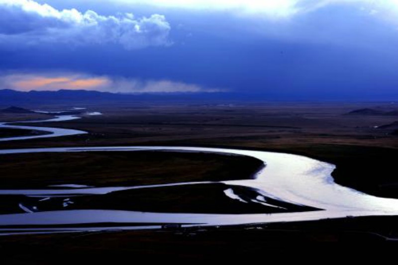
The Upper Course
The Yellow River originates at an elevation above 15,000 feet (4,600 metres) in the Bayan Har Mountains, in the eastern Plateau of Tibet. In its upper reaches the river crosses two large bodies of water, Lakes Ngoring and Gyaring. Those shallow lakes, each covering an area of about 400 square miles (1,000 square km), are rich in fish and freeze over in winter. The Yellow River in that region flows generally from west to east. The broad highlands of the upper course rise 1,000 to 1,700 feet (300 to 500 metres) above the river and its tributaries. The highlands consist of crystalline rocks that are sometimes visible as eroded outcroppings on the surface. The river enters a region of deep gorges, winding its way first southeast, then northwest around the A’nyêmaqên (Amne Machin) Mountains, where its fall exceeds 10 feet per mile (2 metres per km), and then east again between the Xiqing and Laji mountains.
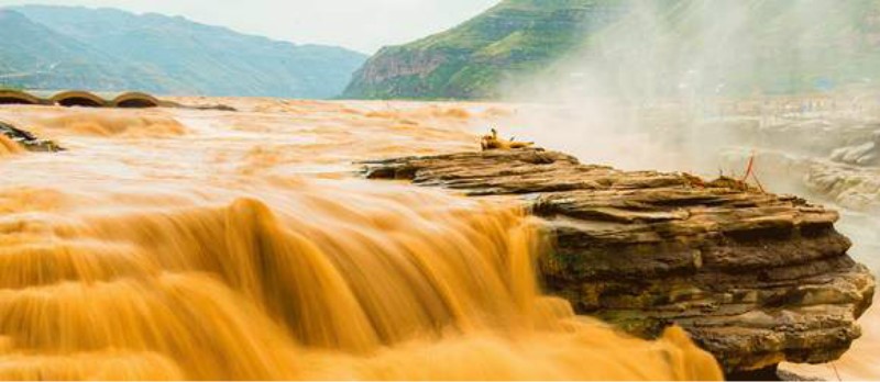
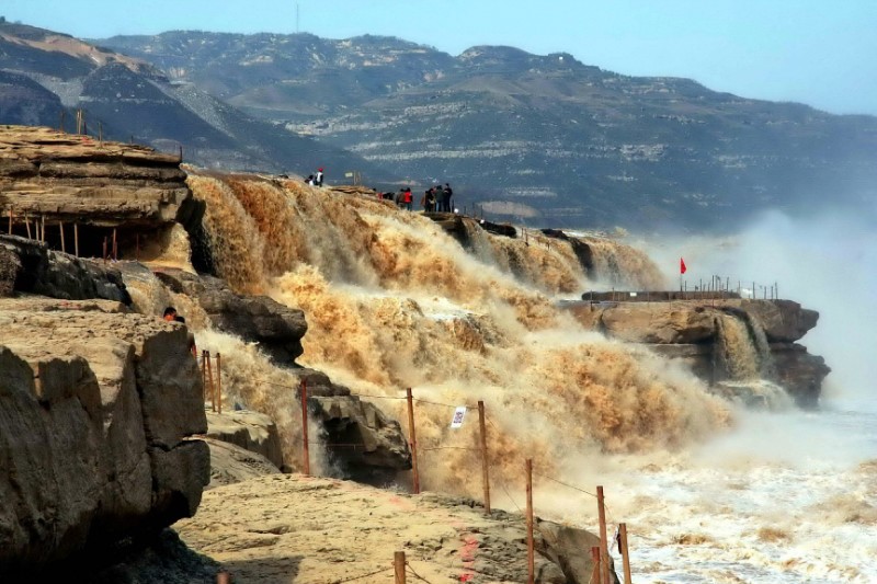
The Middle Course
The middle course of the Yellow River, extending more than 1,800 miles (2,900 km), consists of a great loop and drains an area of about 23,000 square miles (60,000 square km). The river at first flows northeast for about 550 miles (880 km) through the sandy soils of the northern Hui Autonomous Region of Ningxia and of the western Ordos Plateau. It has many rapids there, and in a number of places it narrows. The river then turns eastward and flows for another 500 miles (800 km) through alluvial plains in the Inner Mongolia Autonomous Region, in places branching into numerous distributary channels. In that stretch its fall is less than half a foot per mile (9 cm per km), and many of the channels have been developed over the millennia for irrigated agriculture.
The Lower Course
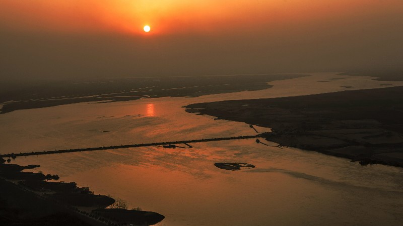
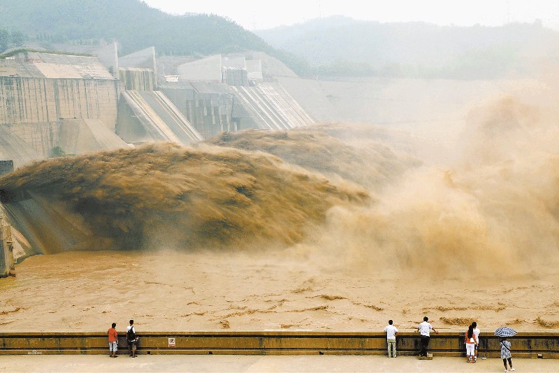
The lower Yellow River is about 435 miles (700 km) long with an average fall of about 3 inches per mile (5 cm per km). Downstream from Zhengzhou the Yellow River broadens out to flow through Henan and Shandong provinces across the North China Plain. The plain is a great, nearly featureless alluvial fan broken only by the low hills of central Shandong; it was formed over some 25 million years as the Yellow River and other rivers deposited enormous quantities of silt, sand, and gravel into the shallow sea that once covered the region. The plain has been densely inhabited for millennia and long has been one of China’s principal agricultural regions. The river has changed its course across the plain several times, and the region’s inhabitants have built extensive systems of levees and irrigation works in an attempt to control the river’s flow. The area illustrates perhaps better than any other place on Earth how human activity has combined with natural forces to shape the landscape.
Leave a Reply